Pano Panagia (Páno Panagiá)
Pano Panayia (Greek: Πάνω Παναγιά); also known as Panayia (Greek: Παναγιά), is a mountainous village in Cyprus, located at an altitude of 900 metres in the Paphos mountain range, on the outskirts of Paphos forest and 35 minutes from Paphos International Airport. The name Panayia refers to Mary, mother of Jesus Christ.
Panayia owes its name to the many churches and monasteries which are in the village or close to it and which are dedicated to Virgin Mary (who in Greek is called Panayia). The most known are the ancient church of Panayia Eleousa in the centre of the village, the historical Chrysoroyiatissa Monastery from the 12th century, and the Byzantine Monastery of Panayia tou Kykkou.
Archbishop Makarios III, the first president of the Republic of Cyprus, was born in Panayia in 1913.
The village is also known for its unique wildlife, including the mouflon; which is protected by Cypriot and international laws as an endangered species. It is also known for a viticultural zone called Vouni Panayias, which is considered by wine connoisseurs as the best in the island.
By the 2001 census Panayia had a total population of 564.
* Panayia Village website
* Panayia village in Chooseyourcyprus
* Vouni Panagias European destination of excellence
* Vouni Panagias-Natura 2000
Map - Pano Panagia (Páno Panagiá)
Map
Country - Cyprus
 |
 |
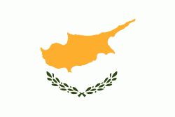
| Flag of Cyprus | |
The earliest known human activity on the island dates to around the 10th millennium BC. Archaeological remains include the well-preserved ruins from the Hellenistic period such as Salamis and Kourion, and Cyprus is home to some of the oldest water wells in the world. Cyprus was settled by Mycenaean Greeks in two waves in the 2nd millennium BC. As a strategic location in the Eastern Mediterranean, it was subsequently occupied by several major powers, including the empires of the Assyrians, Egyptians and Persians, from whom the island was seized in 333 BC by Alexander the Great. Subsequent rule by Ptolemaic Egypt, the Classical and Eastern Roman Empire, Arab caliphates for a short period, the French Lusignan dynasty and the Venetians was followed by over three centuries of Ottoman rule between 1571 and 1878 (de jure until 1914).
Currency / Language
| ISO | Currency | Symbol | Significant figures |
|---|---|---|---|
| EUR | Euro | € | 2 |
| ISO | Language |
|---|---|
| EN | English language |
| EL | Greek language |
| TR | Turkish language |


